Contact Us. Web site contents copyrighted. All rights reserved. Made With Serif WebPlus. Home

Big Sage Thinning Project Before Thinning
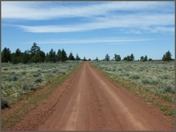
The Forest Service road, 43N18, serves as a boundary for some of the Big Sage Allotment Juniper Thinning Project. In this part of the project, the road runs in a northwesterly direction. In the image to the right, the completed project is on the right and to the left is outside the project.
In the satellite image below, taken in 2010 BEFORE the project, the blue pin is the location where the picture of the road was taken. The project area is above the road and below the road is outside the project.
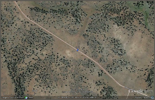
In this 2010 satellite image, above the road and below the road look essentially the same. There is a mosaic of lower elevation open places with little or no trees. The density of the juniper on both sides of the road is the same, sparse and open. On the ground, the soil types are the same on both sides of the road with the rocky elevated areas populated with mostly old growth western juniper. The project description for the Big Sage Allotment clearly stated that no old growth juniper would be cut, yet the Modoc National Forest implemented a juniper thinning project in an old growth woodland where over 80% of the old growth juniper were then cut down.
To the right is a gallery of pictures from outside the project immediately across the road from the completed project at the blue pin in the satellite image. This is what the Big Sage Allotment looked like before the Forest Service cut down over 80% of the old growth western juniper. There never should have been such a juniper thinning project in this or any old growth juniper woodland.
Before the Big Sage Juniper Thinning Project
Measuring stick has six inch increments.
Google recently updated their satellite images for northern California, including the Modoc National Forest. Now we can show by satellite the damage done to this old growth juniper woodland by the Forest Service thinning project.
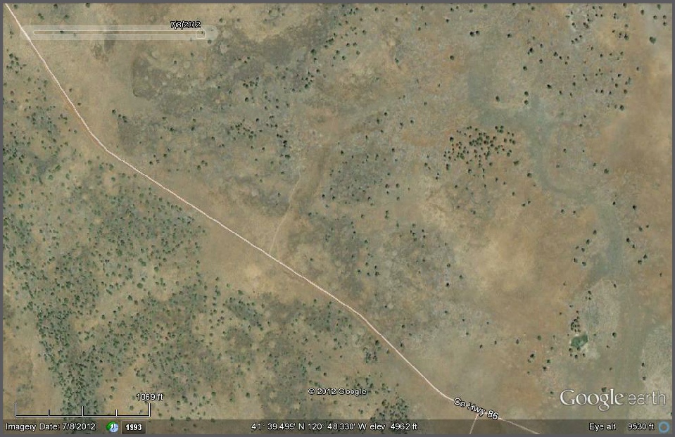
Below are two satellite images of part of the Big Sage Allotment Phase I juniper thinning project. As in the image above, the project site is above the road and below the road is outside the project. The two images cover exactly the same area. The first image below shows this part of the project as an old growth juniper woodland BEFORE the thinning was implemented. The second image below shows what the Forest Service left of this old growth juniper woodland AFTER their juniper thinning project that cut down mostly old growth western juniper.
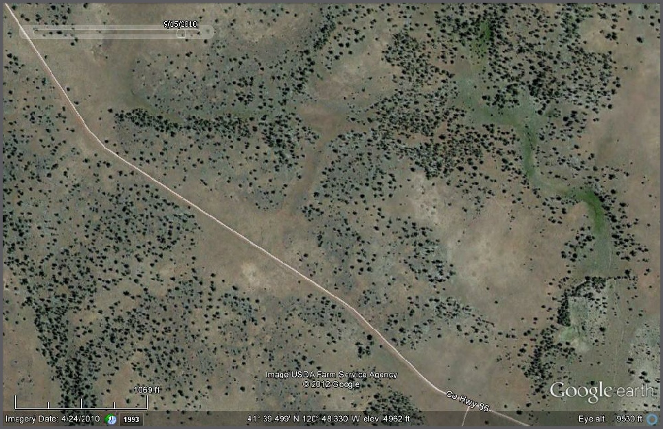
April 4, 2010: How the Old Growth Juniper Woodland Chosen by the Forest Service for a Thinning Project Looked BEFORE Thinning.
July 8, 2012: How the Old Growth Juniper Woodland Looked AFTER the Forest Service Cut Over 80% of the Old Growth Juniper.
Some Trees Cut Down Were Over 600 Years Old.